

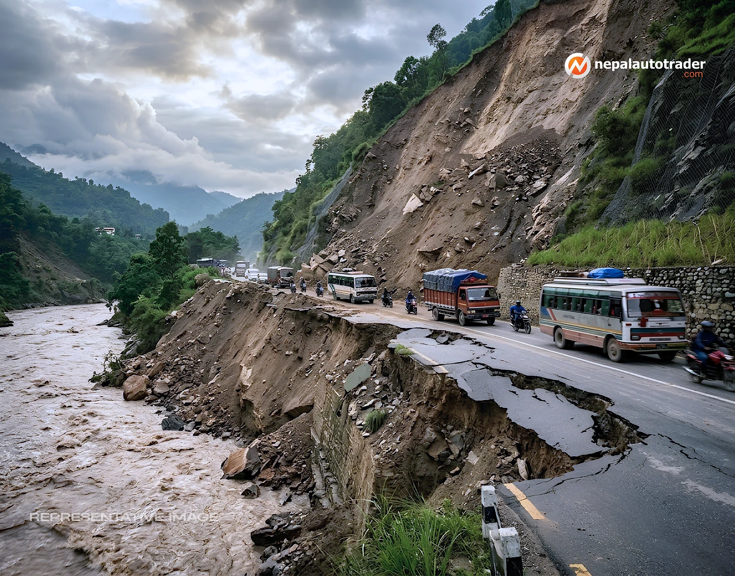
There are road landslides in Nepal that close a highway for a few hours. Then there is Krishna Bhir.
Located beside the Prithvi Highway in Dhading, roughly 83 km from Kathmandu Valley, the cliff has spent decades reminding Nepal that a road can be engineered, paved and expanded, yet still remain at the mercy of the mountain beneath it. Academic studies describe Krishna Bhir as a notorious landslide zone, with weak geology, deforestation, poor drainage and mechanical disturbance all contributing to slope instability.
Its importance comes from what sits below the slope. The Prithvi Highway is one of Nepal's most important east-west transport corridors, linking Kathmandu with the western road network. When Krishna Bhir fails, the problem is not confined to one bend in Dhading. Traffic, freight and supplies are forced to find another way.
That is why the history of Krishna Bhir matters now. The latest failure is serious, but it is not without precedent.
The defining episode came in the monsoon of 2000. According to the Department of Roads, a huge landslide struck Krishna Bhir on 11 August 2000, at chainage 57 km of the Prithvi Highway. Traffic remained blocked until 21 August, with single-lane movement finally restored on 22 August after sustained day-and-night clearance work.
| Milestone | Confirmed detail | Why it mattered |
|---|---|---|
| 11 August 2000 | Major landslide at Krishna Bhir | Prithvi Highway traffic was blocked |
| 11 to 21 August | Highway remained blocked | Long disruption exposed the corridor's vulnerability |
| 22 August 2000 | Single-lane traffic restored | Movement resumed after intensive clearance work |
| 2004 | Civil and bio-engineering measures implemented | Slope stabilization became more systematic |
The causes were debated even at the time. The Department of Roads recorded arguments involving heavy cutting and blasting during road construction, inadequate geo-environmental treatment and cultivation on the hilltop. Later research added weak geology, rapid deforestation, inadequate drainage and increased mechanical activity to the list of factors that weakened the slope.
Whatever the balance between those factors, the lesson was brutally clear. Krishna Bhir could not be treated as a routine maintenance point.
After repeated failures, engineers began looking beyond conventional slope protection. A case study on Krishna Bhir records that the Department of Roads, under the supervision of engineer N. M. Shakya, implemented a combined civil engineering and bio-engineering approach in 2004. The idea was simple in principle, but ambitious in practice: control the moving mass with structures while using vegetation to strengthen and protect the slope.
That distinction matters. Bio-engineering does not mean planting grass and hoping for the best. Nepal's roadside slope work has used techniques such as brush layering, palisades, live check dams, fascines and vegetative stone pitching to reduce erosion and improve soil stability.
The result was significant. The research literature describes the combined system as effective for more than a decade, while also warning that poor preparation, implementation, maintenance, monitoring and evaluation can cause previously stabilized slopes to deteriorate again.
In other words, Krishna Bhir was not defeated. It was managed.
The current crisis exposes the limit of that earlier success.
On Sunday, flooding in the Trishuli River eroded the hillside at Krishna Bhir in Benighat Rorang Rural Municipality, Dhading. The road first subsided, then a further landslide swept away the remaining section. Police said landslide activity was still continuing, and movement on foot had also been stopped.
This time, the problem is not simply material falling from above. The river is actively attacking the lower part of the slope while unstable ground remains above. The Department of Roads has started a technical assessment, but the combination of river erosion below and continuing movement above makes a quick temporary track difficult.
That is an important distinction. The mountain has changed the engineering problem.
With the direct route closed, traffic must spread across four reported alternatives. Their limits become obvious when the distances are placed side by side.
| Alternative route | Reported distance | Reported travel time | Key constraint |
|---|---|---|---|
| Kanti Lokpath | About 155 km to Narayangadh | About 4.5 to 5 hours | Narrow and winding, difficult for large vehicles, night movement restricted |
| Sisneri or Pharping Kulekhani Hetauda | About 160 km to Narayangadh | About 5 to 6 hours | One-lane section between Deurali and Bhimphedi |
| Tribhuvan Rajpath | About 205 km to Narayangadh | About 6 to 7 hours | Narrow and winding before Hetauda |
| Abukhaireni Arughat Mid Hill Highway | About 160 to 170 km to Abukhaireni | About 5 to 6 hours | Mostly blacktopped and suitable for large vehicles |
Three of these alternatives head through Hetauda and Chitwan before continuing west, while the Mid Hill Highway route takes traffic through Gorkha.
For passenger cars, that means longer journeys. For buses, trucks and other large vehicles, it means something more serious: road geometry becomes a deciding factor.
Krishna Bhir's story is not really about whether Nepal can build a strong enough retaining wall. It is about whether a complex Himalayan slope can be managed as a living system.
The earlier bio-engineering work showed that it can, at least for a time. Research published in 2023 found that bio-engineering had helped control landslide and soil erosion problems at Krishna Bhir, but also concluded that weaknesses in design, implementation, maintenance and monitoring contributed to the slope's later deterioration.
The present failure adds another layer. The Trishuli River has attacked the toe of the slope, while the hillside remains unstable. Any permanent response therefore has to address both sides of the problem, not just the road surface.
That may mean stronger riverbank protection, improved drainage, renewed slope treatment and, where technically justified, larger structural interventions. But the precise solution should come from the ongoing engineering assessment, not from assumptions made before the ground is understood.
There is also a more immediate concern. The current closure is already forcing vehicles onto secondary roads, just as other sections of Nepal's road network are coping with flood damage. Bailey bridge installations elsewhere as authorities work to restore damaged links.
Krishna Bhir has fallen before. Nepal managed to bring it under control before, too. The difference now is that the river has become part of the equation.
And that makes the next fix more important than simply reopening one lane. The real objective is to keep the mountain road moving when the mountain decides it does not want to.
Q: When did the major Krishna Bhir landslide occur?
A: The Department of Roads records a major landslide on 11 August 2000. The Prithvi Highway was blocked until 21 August, with single-lane traffic restored on 22 August.
Q: Why was Krishna Bhir historically prone to landslides?
A: Research identifies weak geology, deforestation, poor drainage and mechanical activity as important factors. The 2000 Department of Roads record also documents debate over road cutting, blasting, geo-environmental treatment and cultivation on the hilltop.
Q: How was the Krishna Bhir slope stabilized?
A: In 2004, the Department of Roads used a combined civil engineering and bio-engineering strategy. The approach included physical measures to manage slope movement alongside vegetation-based techniques to control erosion and strengthen the surface.
Q: Why has Krishna Bhir become unstable again?
A: Recent research says the slope's earlier stability was not permanent, particularly where design, maintenance, monitoring and evaluation were inadequate. The latest failure also involves Trishuli River erosion at the base of the slope, according to the current report.
Q: What are the current alternatives to the Prithvi Highway?
A: Kanti Lokpath, the Sisneri or Pharping Kulekhani Hetauda routes, Tribhuvan Rajpath and the Abukhaireni Arughat Mid Hill Highway route. Reported travel distances range from about 155 km to 205 km for the listed destinations, depending on the route.
Q: When will the Prithvi Highway reopen at Krishna Bhir?
A: No confirmed reopening date has been given. The Department of Roads is conducting a technical assessment, while continuing landslide activity and river erosion make immediate reopening difficult.

Nepal Auto-Trader is one-stop platform for all automotive needs. We provide unbiased and unparalleled news/reviews of all auto-motives being launched in Nepalese Auto-Industry. Find recent updates and price of bikes/cars, compare and review recently launched bikes/cars, buy/sell/trade reconditioned cars/bikes and all government news about changing rules and regulation, road safety by subscribing us.

Subscribe to our Newsletter
© Copyright 2026, Nepal Autotrader


.png)
.png)